Incredible Things to Do in Big Sur + Where to Stay
If you’re planning a road trip down California’s Highway 1, it isn’t complete without a trip through Big Sur. The beautiful drive officially starts in the Carmel Highlands and continues for about 70 miles to San Simeon. The winding and narrow road hugs the cliffs of the California coast and is one of the most scenic drives in the country. You will be dazzled with diverse scenery — dramatic coastline, lush forests laced with fresh scents of pine and eucalyptus, fields of wildflowers, and hiking trails that lead you through mammoth groves of sagacious redwoods.
There is so much to see along the route — from popular tourist attractions to lesser-known spots hidden for only the most adventurous to find. When planning your itinerary, don’t miss these sights and things to do in Big Sur!
This article contains affiliate links (paid links) and Veggies Abroad is a member of Amazon Services LLC Associated Program. At no cost to you, I may earn a small commission if you make a purchase — this helps keep Veggies Abroad churning out free content! For an explanation of our advertising partnerships, please review our privacy policy.
The Most Beautiful & Scenic Things to Do in Big Sur
Point Lobos State Natural Reserve
62 CA-1, Carmel-By-The-Sea, CA 93923
This is one of the best stops along the Pacific Coast Highway. Point Lobos is filled with breathtaking scenery — striking ocean cliffs, rolling meadows, rich flora and fauna, and active wildlife.
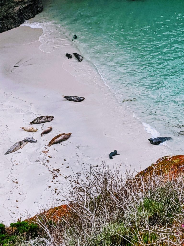
From April – May, visitors may get the chance to see baby seal pups. These two months mark Harbor Seal pupping season, visitors are asked to quietly observe the moms and pups as they take refuge at Whalers Cove, China Cove, Bluefish Cove, and Moss Cove. We were lucky to see a group resting on the beautiful beach at China Cove. This was one of my favorite sights in Big Sur. It was beautiful to see these little pups with their moms!
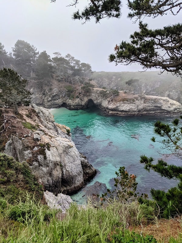
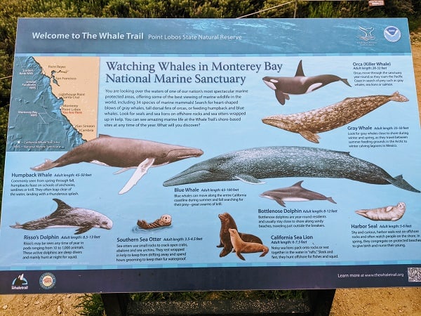
From December to May, lucky visitors can catch a glimpse of migrating gray whales (they generally travel very close to the shore.) Humpback and Blue Whales also pass through the area. The best way to see them is by watching for “spouts” (a fountain or stream of water being forced out of the whale’s lungs). Aside from whales and sea lions, the area is also home to sea otters, dolphins, and thousands of seabirds.
Point Lobos also has a variety of easy hiking trails that wind around the shoreline, through the meadows, and connect many of the most scenic spots in the Reserve. The trails range in distance from just under a mile to 3 miles. Docent-led walks of the Reserve are also available daily. This is a great way to learn about the nature and history of the area and uncover hidden spots.
Garrapata State Park
34500 CA-1, Carmel-By-The-Sea, CA 93923
Garrapata State Park doesn’t get the same attention as some of the other parks throughout Big Sur but that means it is unspoiled for the visitors who make the stop. There is only one park sign followed by multiple unmarked turnouts, so it is easy to buzz right by it. The park covers both sides of the highway. On the coastal side, there are multiple walking paths that follow the rocky coast allowing for picture-perfect views.
On the other side of the highway, head past the park gate to hike the 2.8-mile Soberanes Canyon Trail. It is an out and back trail because as of February 2023, the second trail, Rocky Ridge is partially closed.
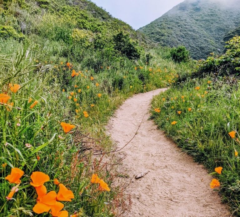
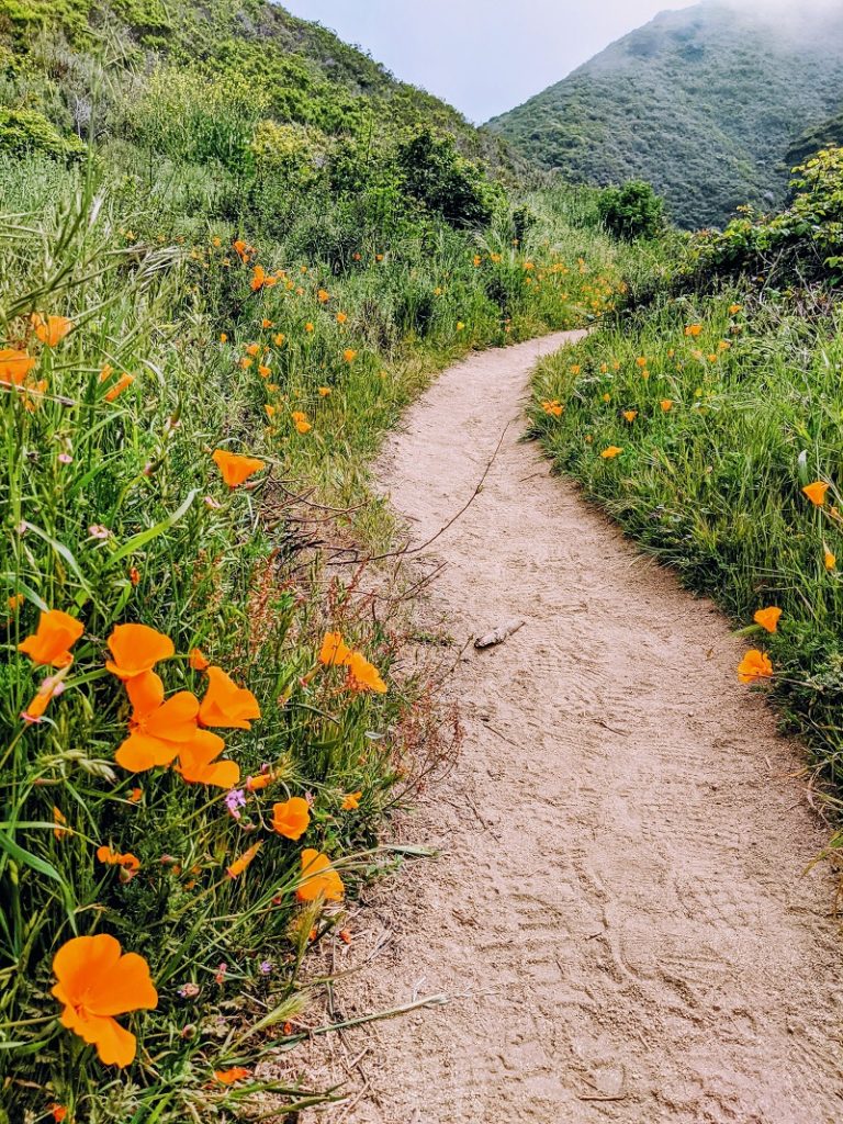
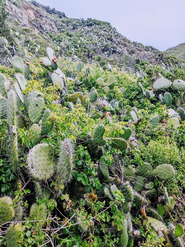
The trail leads you through a diversity of plant life from mammoth pines to cacti and when the entire loop is open it ends with panoramic coastal views. The entire loop is considered strenuous, due to the closure we only completed part of the Soberanes Canyon Trail and didn’t find it overly difficult. In spring and early summer, the park is flush with a variety of wildflowers including California poppies, buttercups, trillium, and many more.
Calla Lily Valley
Garrapata Trail, Carmel-By-The-Sea, CA 93923
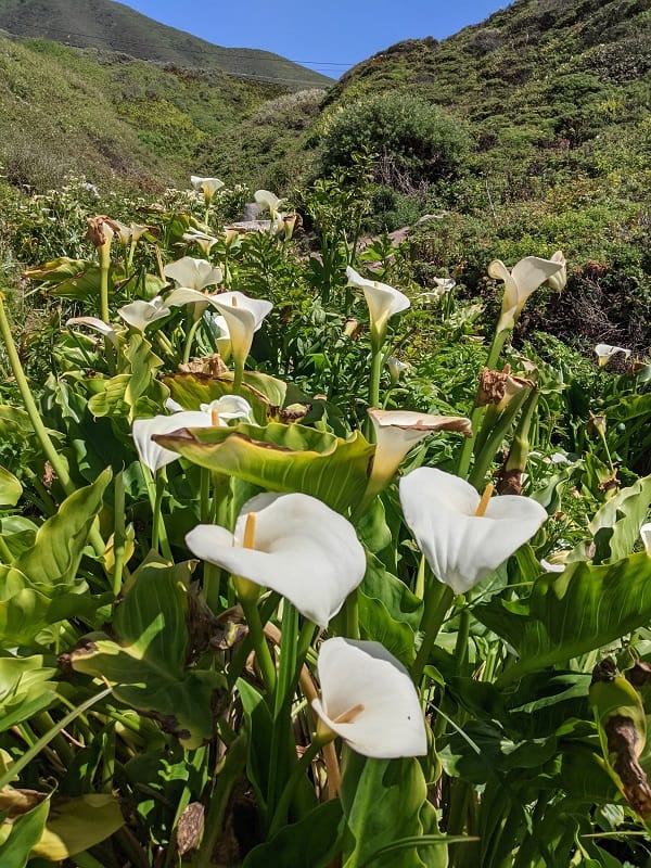
This secret valley is part of Garrapata State Park and is filled with tons of Calla Lilies. This spot is not marked from the road, the best way to find it is to plug it into Google Maps and keep a lookout for parking on the shoulder of Highway 1. It is not far from Garrapata State Park’s gate 19.
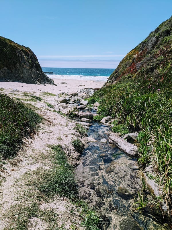
Once you arrive, hike down the path from the road which will open into Doud Creek, where you will find the beautiful lilies. At first, it may seem like this is any old hiking path near the coast but keep going to get to the lilies. The creek opens into Garrapata State Beach. This is a beautiful spot to have a picnic on the beach or just relax. Because it’s not marked, it isn’t overrun with tourists so you can truly enjoy the scenery.
The best time to catch the Calla Lilies in bloom is late January – early May.
Bixby Bridge
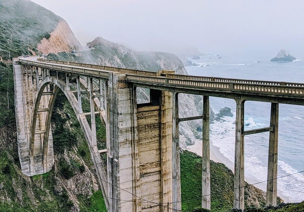
No hiking or strenuous activity at this stop. Some may say it’s overrated but truly it’s a beautiful spot — the iconic bridge, the steep cliffs, and crashing waves. The bridge was completed in 1932 for just over $200,000 – which today would be about $3.8 million – in terms of California costs, that seems like a deal! The bridge soars 260 ft. from the bottom of the Bixby Creek Canyon and is one of the tallest single-span bridges in the world.
Aside from tourist photos, the bridge has appeared in many commercials, postcards, and tv shows, including one of my favorites, HBO’s Big Little Lies. While capturing the bridge and the area be aware this area is known to have a lot of accidents. Be careful crossing the road and pulling back out into traffic.
Pfeiffer Big Sur State Park
Pfeiffer Big Sur Rd, Big Sur, CA 93920
This is the perfect stop for a day hike or to spend a few days and camp. One important thing to note, this park isn’t on the coast and there isn’t beach access. Pfeiffer Beach is about one mile south of the park’s entrance and you will want to make sure you stop there too.
The secluded beach is located off the narrow and winding Sycamore Canyon Road. The beautiful spot is known for its massive keyhole arch, which if the lighting is right can make for amazing photos. A little further down the beach check out the purple sand that is created from manganese rocks found in the cliffs.
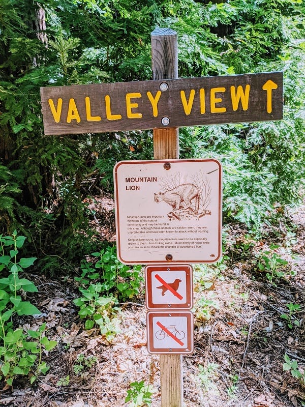
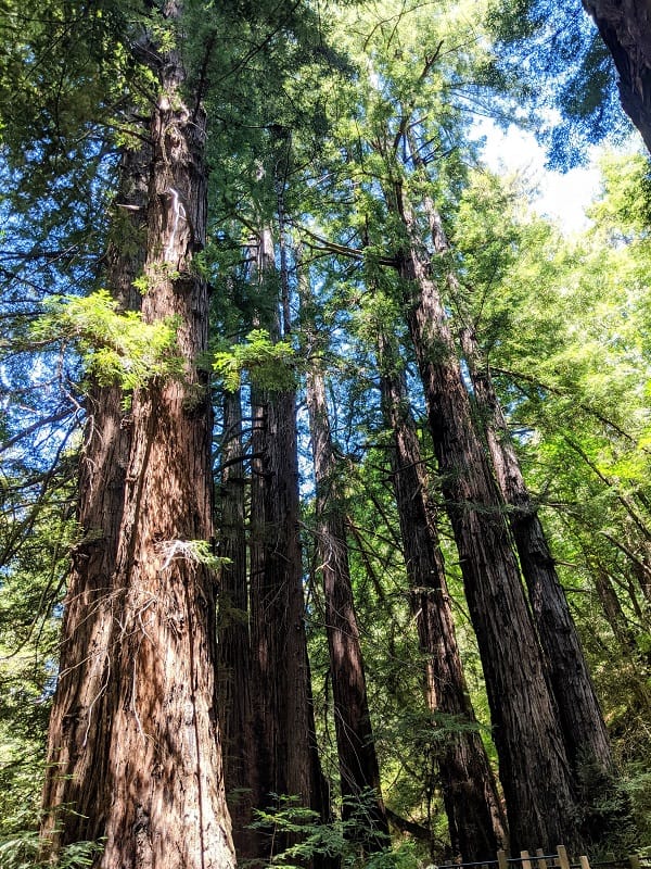
Pfeiffer Big Sur State Park is a wonderful place for scenic hikes through the redwoods, conifers, oaks, and many more to panoramic vistas of the ocean and Santa Lucia Mountains. We had planned to take the Pfeiffer Falls Trail to see the beautiful Pfeiffer Falls Waterfall but unfortunately, it was closed, so instead, we took the Valley View trail.
It was a moderate 2-mile out-and-back hike that offered views of Big Sur River Valley. There are six other trails that are currently open that range in length from .5 mile to 23 miles (one way). If we would’ve had time, we would’ve also hiked Buzzard’s Roost. This trail is 3 miles roundtrip and offers beautiful views of the ocean, Sycamore Canyon, and the mountains — grab a hiking map before you go!
Fun fact about redwoods — due to a drier climate, the ones found in the central part of the state are generally smaller than those in the northern part of the state. On average, northern redwoods reach heights of 350 ft., while central redwoods reach around 250 ft.
Partington Cove
51700 CA-1, Big Sur, CA 93920
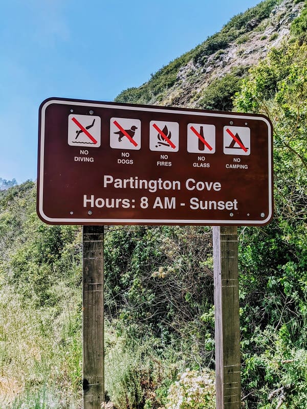
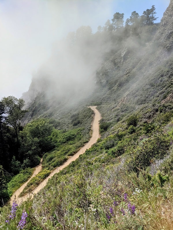
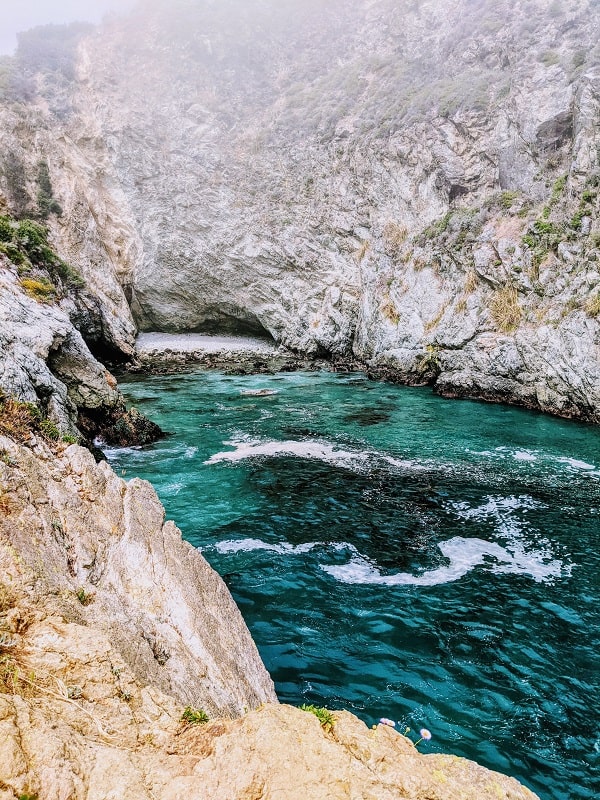
This remote cove is a part of Julia Pfeiffer Burns State Park and is not marked from the road. The only reason we stumbled upon it is because we saw a few other people descending an unmarked trail and thought, what’s down there? Our intrigue motivated us to pull over on the side of the road and investigate. There is no official parking, parking is available on the shoulder of Highway 1.
The trail down to the cove starts on a dirt road just behind the gate off of Highway 1. After following the road, the trail splits into two paths. The trail on the right will take you down to a remote ocean cove and the trail on the left leads over a small bridge, through a tunnel to a rocky point for more beautiful coastal views. Make sure you wander through both trails, it’s not an extensive hike, approximately one-mile round-trip.
Julia Pfeiffer Burns State Park
52801 CA-1, Big Sur, CA 93920
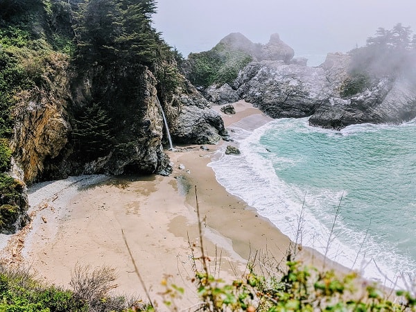
The park has seven trails that range in length from ½ mile to 5 miles, but many of the trails were closed when we visited. Lucky for us, the popular Waterfall Overlook/McWay Falls trail was open.
This is a popular trail for visitors because of its natural beauty. The short trail is only .5 mile and snakes along a cliff that peers over a beautiful cove that reminded me of something you’d see in Hawaii. The cove is also home to the small waterfall, McWay Falls. The other trails in the park take you inland through groves of redwoods, but be sure to check ahead to ensure the trails are open. If you stopped at Pfeifer Big Sur State Park, your entrance fee includes your visit here.
Sand Dollar Beach
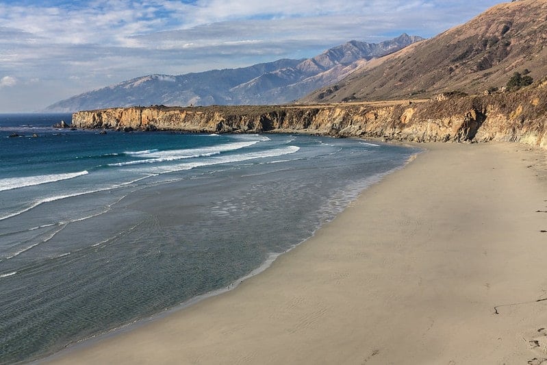
With all that driving, you might need a break, and this is the perfect spot! The narrow beach is part of the Andrew Molera State Park and is popular for surfing (not ideal for swimming) and beach combing. The beach gets its name from the plethora of sand dollars that get washed up, but you also might find other minerals like jade and serpentine (remember that there are rules regarding taking minerals home with you).
There are a few trails, including a short one that leads to a look-out point. The beach is open daily from 10 AM – 6 PM and parking is $10.
Limekiln State Park
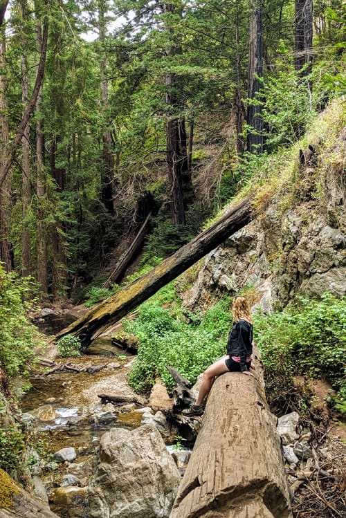
This is a unique park; not only is it home to terrific hiking and natural beauty, but you can still discover some of California’s history. The park was once home to a prosperous limekiln operation. In the late 1800s, limestone was harvested nearby and processed in these giant kilns, which was used to make cement that was instrumental in building San Francisco and Monterey.
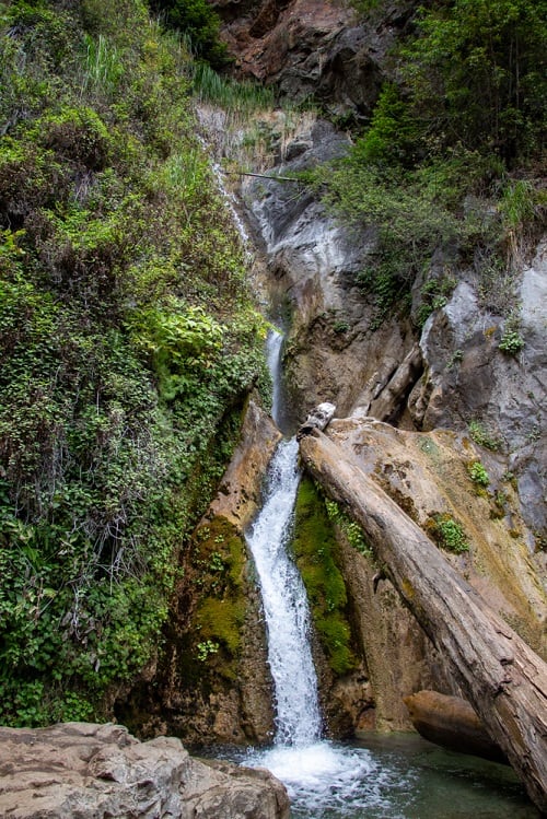
Today, the kilns aren’t in operation (thankfully) and the forest has been able to re-grow, providing shady paths for visitors to explore. There are a few different hiking trails to explore that range from 2-3 miles within the peaceful forest. If you can only choose one, check out the waterfall trail (I’m sure you can guess why I suggest it).
Piedras Blancas Elephant Seal Rookery
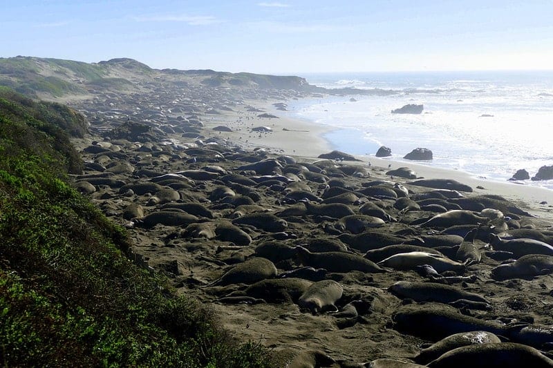
You can’t miss stopping at this giant elephant seal hangout — it’s one of the largest of its kind! All year long, elephant seals call the shores (approximately 8 miles) of the Piedras Blancas State Marine Reserve home, but during peak times of the year (January, April, and October), you could find over 20,000 of them — you’ll hear them before you see them! You’ll find docents ready to answer all your elephant seal questions along the viewing platforms.
To learn more about these giants, visit the Friends of The Elephant Seals visitor center. The organization is a non-profit that is dedicating to educating the public about the importance of marine life.
Where is The Best Place to Stay to Explore Big Sur?
If you want to explore all of Big Sur, the best option is to choose a few hotels along Highway 1. Otherwise, if you only base yourself in one spot, you will spend a ton of time driving and will only be able to see some things on your itinerary.
I suggest you first stay in Carmel-By-The Sea, then somewhere near Pfeiffer Big Sur State Park, and end near San Simeon. There is one big but with this — San Simeon can’t technically be your end if you are flying home. San Francisco (SFO) and Los Angeles (LAX) are the closest international airports — both are about a 3.5-hour drive. If I were you, I wouldn’t go north and leave via SFO; I would continue and go to LAX and spend at least one day in Los Angeles.
Here are a few suggested hotels along the route:
Hotels in Carmel-By-The-Sea
Junipero St &, 8th Ave, Carmel-By-The-Sea, CA 93923
Book the HideawayJunipero Street &, Ocean Ave, Carmel-By-The-Sea, CA 93923
Book The GetawayHotels Near Pfeiffer Big Sur State Park
One note about hotels in this area, there aren’t a ton! If you’re traveling during the summer, make sure you book early.
47225 CA-1, Big Sur, CA 93920
Book Big Sur Lodge46800 CA-1, Big Sur, CA 93920
Book Big Sur River InnBig Sur Travel Tips
- Cell phone service is spotty to nonexistent, make sure you download the Google map of the area before you go! I lost service just outside of Carmel Highlands. The map is a really important tool to be able to find some of the spots that aren’t marked.
- Drive and park carefully. The risk of accidents along Highway 1 is high. The narrow and winding road coupled with people parking on the shoulders and darting back and forth can be a recipe for disaster.
- Dress in layers. The winds off the coast can be chilly and a drastic change to temperatures inland.
- Pack snacks and/or lunch. There are a few restaurants along Highway 1, but they are pricey and not very vegan-friendly. Sure, you can modify a salad, or might find a veggie burger but I don’t think it’s worth $20+.
- Check the weather before you plan your day. Some days the fog can be very dense, which will inhibit your views.
More Vegan Travel Help
If you’re looking for help to plan your Big Sur adventure or maybe you’re checking out other California hot spots, then check out these guides and articles!
Vegan Travel Guide to Monterey, Carmel-by-the-Sea, & Pacific Grove
8 Gorgeous Big Sur Hiking Trails to Explore
16 Can’t Miss Vegan Restaurants in San Francisco
Comprehensive Vegan Travel Guide to LA
13 Mouthwatering LA Vegan Bakeries

