9 Best Pictured Rocks Hiking Trails to Explore in 2026
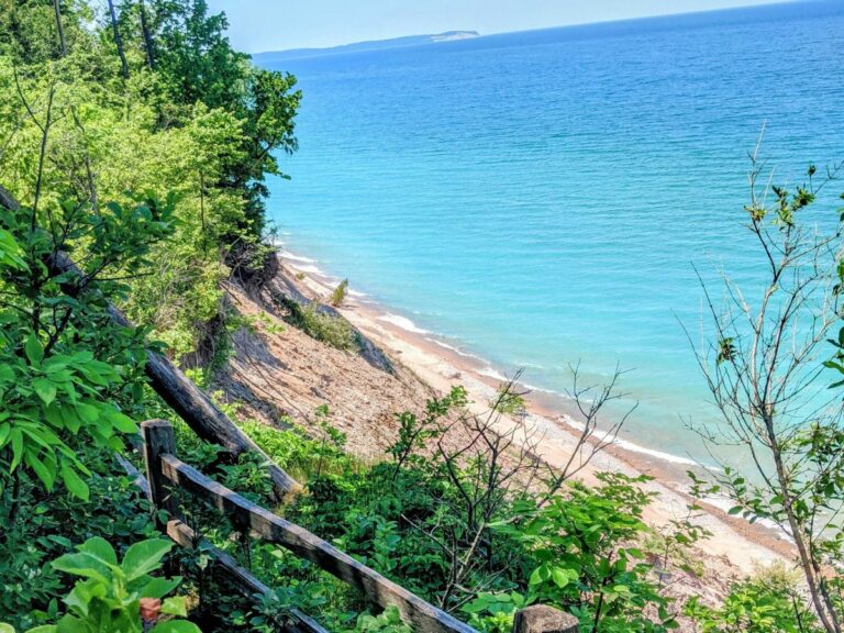
The Pictured Rocks National Lakeshore is one of Michigan’s most beautiful places to hike. It’s home to over 100 miles of trails that lead visitors along the park’s iconic painted cliffs, past roaring waterfalls, and through fragrant forests filled with white pine, maple, and beech trees. No matter if you’re an experienced hiker, looking for a multi-day hike, or just interested in a short jaunt, there’s a trail for you! This guide features a variety of fantastic hiking trails throughout Pictured Rocks — all you have to do is grab your water bottle and decide which one you want to tackle first.
This article contains affiliate links (paid links) and Veggies Abroad is a member of Amazon Services LLC Associated Program. At no cost to you, I may earn a small commission if you make a purchase — this helps keep Veggies Abroad churning out free content! For an explanation of our advertising partnerships, please review our privacy policy.
Longer to Multi-Day Pictured Rocks Hiking Trails
These trails range from just over a mile to 42 miles — there’s something for just about everyone! A couple of notes before you start planning your hiking adventure, don’t forget to download the Pictured Rocks hiking trail map and Google Map before you go — cell service is spotty at best. Secondly, you can break some of the longer trails into smaller increments; double-check the map before heading out.
1. Chapel Loop Trail
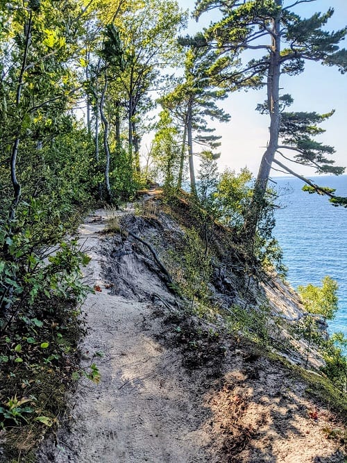
We’re kicking this list off with the best hiking trail in Pictured Rocks — if you want epic views, don’t miss this. The 10-mile loop starts at the Chapel/Mosquito trailhead and weaves through a peaceful forest of maple and birch trees to a secluded beach and past two waterfalls.
There are technically multiple trails within this loop (in case you want to avoid a 10-mile hike), but all start at the Chapel/Mosquito trailhead. The best way to get a good overview of the area is to check out this map created by the National Park Service.
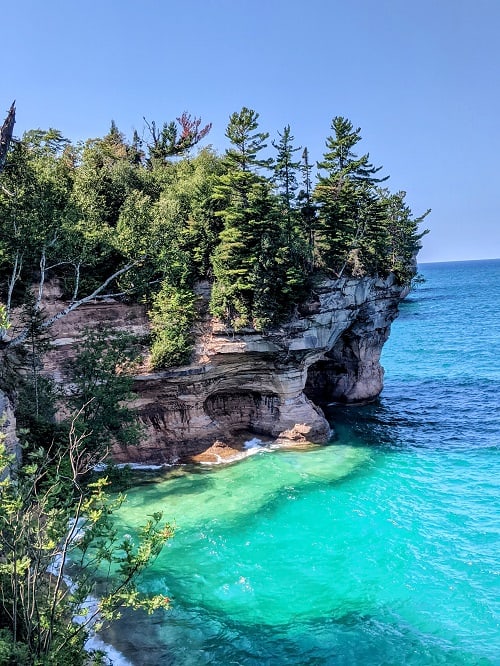
The first section of the hike from the trailhead to Chapel Beach is approximately 3 miles (one-way). Chapel Beach is a must-see spot — the white sands and turquoise waters look as if they belong in the Caribbean, not Michigan! From there, the trail narrows and snakes along the iconic painted cliffs. There are no barriers throughout this section, which is ideal for picture-taking, but you must be careful! After the cliffs, you’ll return to the forest and head past Mosquito Falls.
A couple of important notes, dogs are not allowed on this trail — if you decide to bring fido and you are caught, you will receive a hefty fine. Lastly, the parking lot is very small. Plan to arrive at the trail early; if the lot is full, you can park on the side of the road.
2. Spray Falls Trail
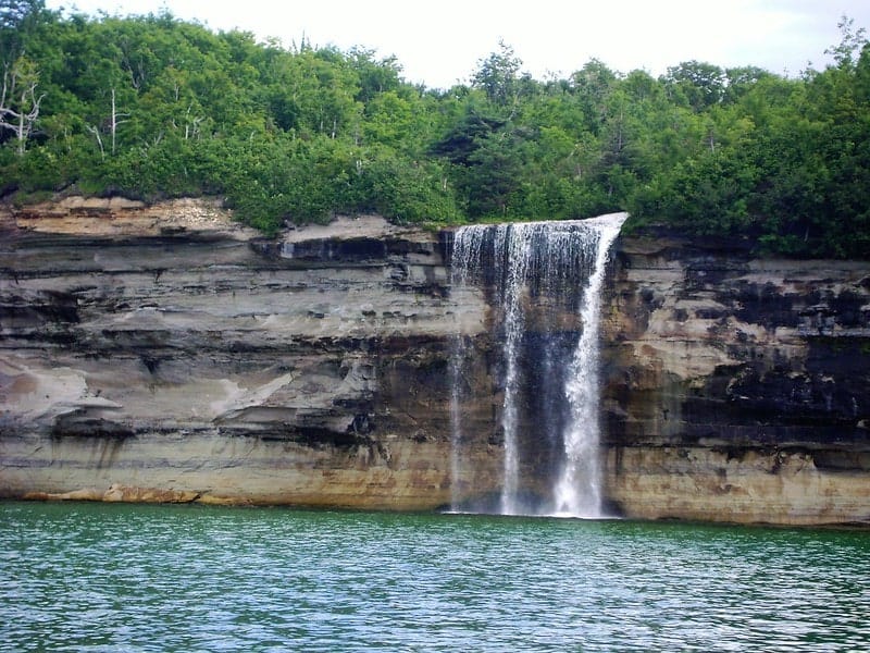
This beautiful 70-ft waterfall plunges directly into Lake Superior and can only be seen from a boat or select spots along the Spray Falls hiking trail.
There are two hiking options for this trail. For a longer hike, approximately 10 miles round-trip, start at the Chapel/Mosquito trailhead and hike to Chapel Beach. The Spray Falls trail connects from there and is 1.7 miles to the waterfall.
For a shorter hike, approximately 8 miles (round-trip), start at the Little Beaver Lake campground and take the Little Beaver Lake Trailhead, which connects with the Lakeshore North Country Trail. From the campground, you’ll pass Little Beaver Lake, Pictured Rocks coves, and views of Grand Portal Point. Just before hitting four miles, you’ll see a sign marking the Spray Falls overlook (the overlook isn’t right on top of the falls; bring a camera with good zoom capabilities).
Most of the hike is flat, but there are a few spots where the trail narrows next to the barrier-free edge of the cliff, and you have to negotiate steep, rocky steps.
One last note, dogs aren’t allowed on this trail.
3. Miner’s Falls Trail
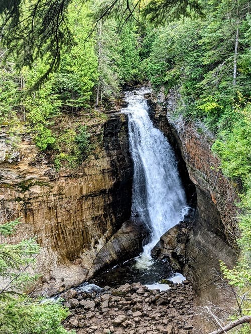
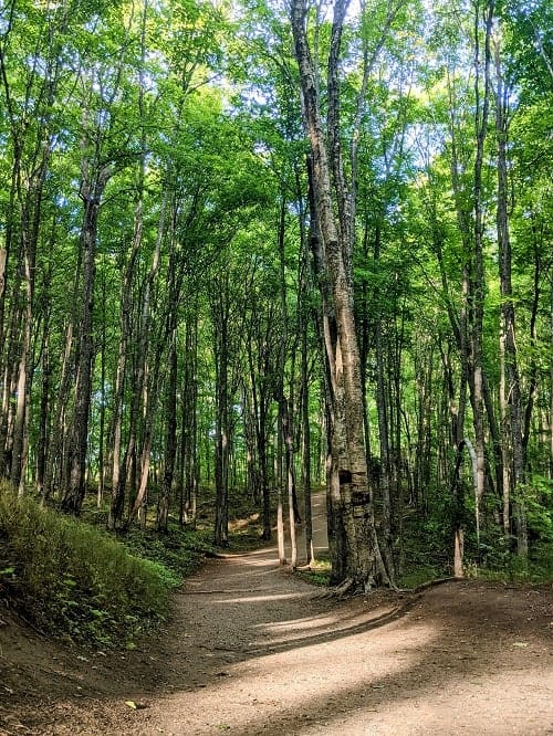
This easy, flat trail leads you through a lush green forest to Pictured Rocks’ most powerful waterfall, Miner’s Falls. There are two viewing platforms that provide unique views of the waterfall.
The out-and-back trail is 1.2 miles (round-trip) and starts at the trailhead located at a small parking lot off Castle Road (H-11). To get there from Munising, head east on Alger County Road until you reach Miners Castle Road, then head east on Miner’s Castle for about 4 miles, and then take a right on Miner’s Falls Road.
Dogs are allowed on this trail as long as they remain on a leash.
4. Miner’s Castle to Miner’s Beach
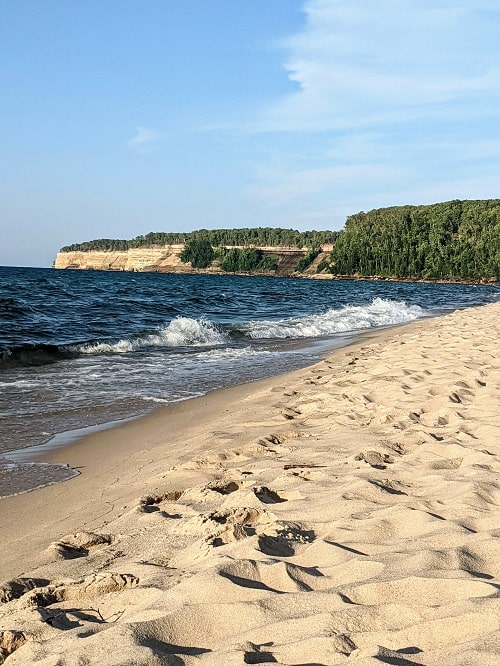
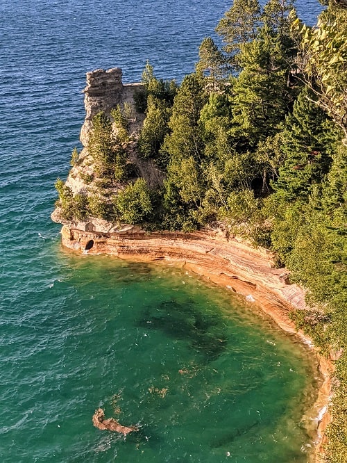
Both of these beautiful spots are must-see sights in Pictured Rocks, and instead of driving to each, why not connect them both with a hike? Start at Miner’s Castle and take the North Country Trail down to Miner’s Beach. The trail between the two spots is only one-mile (one-way); you can make it a little longer by strolling Miner’s Beach, which is a little under one mile long. If you time it right, this is one of the best places to catch the sunset in Michigan’s UP.
To get back to Miner’s Castle, just head back the way you came. One last note, you can visit each of these places separately if you’re short on time.
5. North Country Trail
If you’ve been thinking that you love all of these trails but are craving a multi-day adventure with camping, then this is for you. This 42-mile trail starts in Grand Marais and ends in Munising and traverses the entire Pictured Rocks National Lakeshore. You’ll get the opportunity to experience the diverse beauty of the area, from mammoth dunes to spectacular cliff-top Lake Superior views — don’t forget your camera.
The trail starts at the Grand Sable Visitor Center in Grand Marais. As you hike back to Munising (Munising Falls is the end point), you’ll pass 13 designated camping areas only available to hikers and some boaters. Before you hike this trail, you must apply for a permit at recreation.gov — don’t forget to bring the permit with you.
A couple of other important notes — download or bring a map of the area with you; it is unlikely that you will have cell service for most of the hike. Dogs are also not allowed in backcountry campgrounds and on many trails. Lastly, review all of the National Park Service’s safety information on food storage (there are bears), trash removal, and cliff safety.
Short Hikes in Pictured Rocks National Lakeshore
All of these hikes are under a mile but still offer the opportunity to experience the area’s beauty.
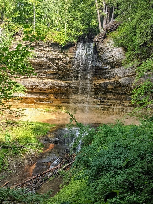
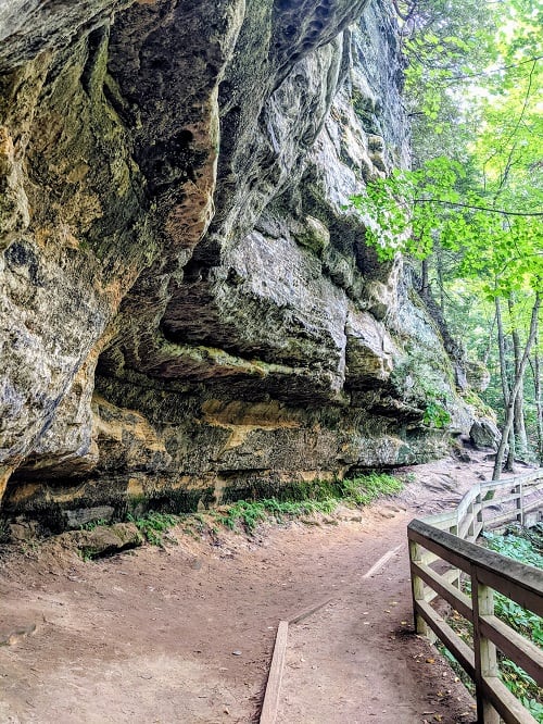
6. Munising Falls
1505 Sand Point Rd, Munising, MI 49862
This shady, paved path is only 800 ft. one-way and ends at the beautiful 50-foot tall Munising Falls viewing platform. Dogs are allowed on this trail as long as they are on a leash!
7. Log Slide Overlook
Highway 58, Grand Marais, MI 49839
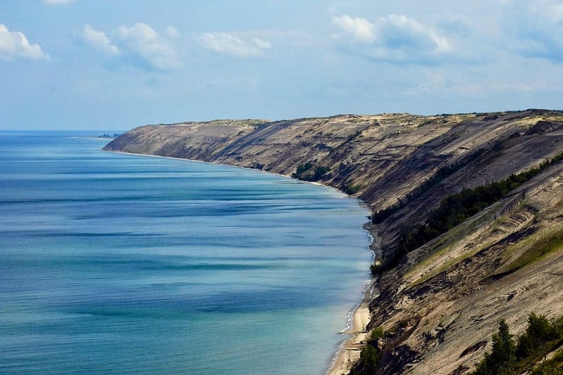
If you’re interested in the Grand Sable Dunes, then check out this .25-mile trail (round-trip). A storm destroyed the viewing platform a few years ago, but you can still enjoy beautiful views of Lake Superior and see where logs slid down the dune to the lake. Dogs are not allowed on this trail.
8. Sable Falls Trail
Sable Falls Road, Seney, MI 49883
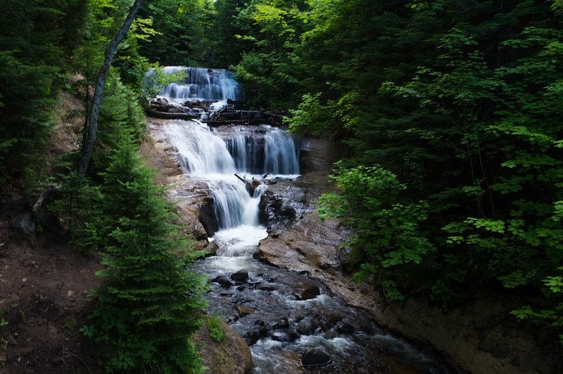
This .4-mile (round trip) trail is part of the expansive North County Trail and features the beautiful Sable Falls and a quiet beach. The trail includes approximately 160 stairs down to the waterfall’s base. Dogs are not allowed on this trail.
9. Grand Sable Dunes Trail
Sable Falls Road, Seney, MI 49883 (Sable Falls parking)
For a bit of dune and forest action (or to build upon the Sable Falls Trail), take this .6-mile (round trip) trail starting at the Sable Falls parking lot. Instead of going down the stairs to the beach, you’ll take the trail near the falls and pass Sable Creek until you reach the dunes. Dogs are not allowed on this trail.
Hiking Essentials
Whether you’re just going for a short stroll or a multi-day excursion, don’t forget some or all of these hiking essentials!
- Collapsible water bottle with filtration
- Vegan & cruelty-free mineral sunscreen
- Packable wide-brimmed hat with SPF protection
- Bug spray —depending on the time of year, mosquitos can be terrible.
- Poison Ivy cream — watch your step when you’re hiking and exploring, Poison Ivy can he found throughout the area.
- Small cooler — I like this one because it’s a back pack, making it ideal for hiking.
When is The Best Time to Hike in Pictured Rocks
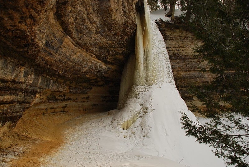
Hands down, the best time to hike is in the summer. Some trails, like Munising Falls, can be explored in the winter, but it takes much more planning and pre-hike research. One advantage of visiting in the winter over the summer is seeing these giant waterfalls turn into ice caves. You can explore and even climb some of the waterfalls. If you choose to do this, the best way to experience the area is on an ice cave tour.
Where to Stay in Pictured Rocks
If you don’t plan to camp, the best place to base yourself to explore this gorgeous area is the charming town of Munising. Here are a few suggestions, but if you’re like more, check out this Pictured Rocks hotel guide.
Looking for More Places to Hike?
You won’t be disappointed by these fantastic hiking hot spots!
Gorgeous Hiking Trails with Waterfalls Views in the Finger Lakes
The Best Hiking Trails in Traverse City
Big Sur Hiking Trails You Can’t Miss


